

The use and importance of geotechnical construction monitoring and tracking have significantly benefited stakeholders for large Engineering Procurement and Construction (EPC) projects. Old and established foundation construction activities had many drawbacks and resulted in an overall economic loss to stakeholders. With the demand for new infrastructure and complex projects, foundation construction requires planned and systemic usage of new modern technologies, and an efficient documentation and data management tracking system.
Value engineering, proper quality management planning and tracking, and geotechnical mapping are cutting-edge technologies and methods for successful foundation construction projects. For EPC and large projects, project delays, failure to complete according to the planned schedule and backtracking often result in low construction quality, cost overruns and overall project failure. Several technologies are adopted by stakeholders these days for monitoring foundation construction and tracking.
The following are a few essential technologies that can be X-factors for any successful geotechnical foundation project.
GeoMapping before and during construction
Engineers, surveyors and geologists use GeoMapping for any geotechnical construction project. It is mainly a collective survey and report before and during the construction of any geotechnical work. It is a process to document past survey data, old geological maps, boring information, soil test data and also data collected during construction to develop an as-built report. Therefore, it can also be referred to as Geotechnical Map Report, where the initial pre-bid survey is carried out for site investigation, determining existing and unknown geotechnical conditions/hazards, developing a site-specific desktop study and creating an as-built mapping report. This helps determine the correct approach to selecting tools, engineering, design and proper planning for the entire project construction.
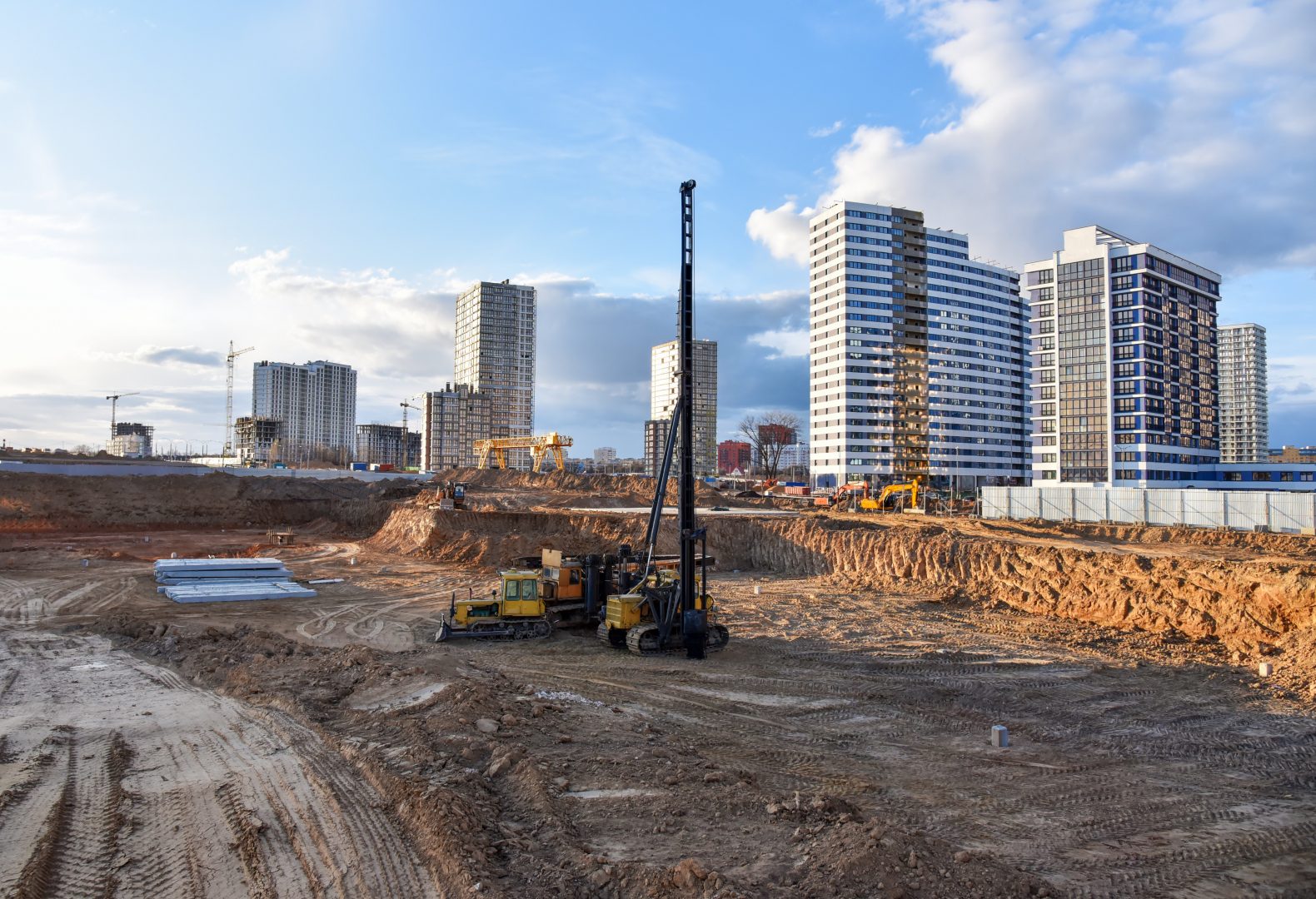
Pre-construction mapping reports include pre-site determination data, any pre-requisite soil testing/boring, engineering behaviour of ground conditions and recommendations for suitable foundation systems/ground improvement methods. It is a tool to optimize any potential overdue during the project and proper planning for the project schedule and cost. Nowadays, the pre-construction report is developed extensively, well-engineered and data-oriented using drone, LiDAR survey and 3D-4D soil/slope modelling. This report benefits engineers in determining the initial design, foundation modelling and the bid-level foundation system.
An as-built mapping report comprises encountered conditions of geological strata and potential geo-hazard conditions during construction. It can be a reference to any modification to a construction tool or engineering design for the future project schedule. In addition, it helps to monitor construction per the designed foundation matrix and expected soil profiles.
GeoMapping and reports are developed using geographic information system (GIS)/CAD mapping and data logging technologies such as ArcMap, LiDAR, Civil CAD and Digital Twin overlapping.
Foundation monitoring determines the health and safety of foundations
Foundation monitoring is essential to track the health and safety of foundation construction by surveying and determining real-time expectations of construction versus design. It ensures construction’s short-term and long-term safety by eliminating any risks, errors and probabilities. It helps a client determine and document the data for future reference. It is an essential tool for off-shore geotechnical construction for successful comprehensive installation and can be referenced for another future project for baseline report development. It serves as an antidote to measure foundation tolerances, proper concrete placement, pile length determination, unexpected ground conditions and many quality assurance/quality control (QA/QC) tests. This can be done using various modern technologies such as differential monitoring of stability, Strain Gauges, AIS, topographic survey and InfraRed Thermography.
GIS monitors construction activities and data
The GIS database is a platform created using ArcGIS and other related geospatial information and integrating it into one database platform. It is one location where data can be analyzed, refined and visualized for an extensive collection. For any large EPC foundation project such as a transmission line, wind farm or electric vehicle station foundation, the GIS database can be a one-step solution system to monitor construction activities and data collection. It is also an easy communication tool for contractors and clients, increasing efficiencies in delivering successful projects. It saves cost overruns, increases time management and automatically generates documents/forms. For successful quality management planning of large foundation projects, this database serves a pivotal role in transparent construction and data tracking. A GIS database can be modified, tracked and customized for specific project requirements. Moreover, it helps in backtracking, QA/QC plans and tracks errors for any foundation structure.
An as-built mapping report comprises encountered conditions of geological strata and potential geohazard conditions during construction.
Documentation of data collection is essential to avoid potential problems and helps assess any current and future schedules. Contractors can develop a customized application program for a management tool, digitalization of forms with QA/QC checks, real-time progress of the project to all stakeholders, generation of tracking sheets and flag any problem in real time. In addition, it helps reduce/track costs aligned to project estimation, quality/production rate improvement and safety.
Using these modern technologies to monitor and track foundation construction, stakeholders can avoid future errors and increase their capacities. In addition, using these technologies saves intangible costs to stakeholders and reduces the time required for documentation, engineering and proper assessments.
This year CZM will break ground on an additional 33,000 square feet of manufacturing space at the North American headquarters. The space will add two assembly lines and a warehouse to the current 40,000 square feet of production space. The new space will also allow CZM to bring production of the forthcoming micropile line to North America and increase the company’s production.
“The additional square footage will let CZM expand its product availability and solidify the company as [a] North American market leader for foundation drill rigs,” said Giuliano. Aube has been joined by his son, Carl, expanding the Canadian sales team to continue CZM’s dedication to their clients. They look forward to continued success in the country and continuing CZM’s high standards for quality and service.